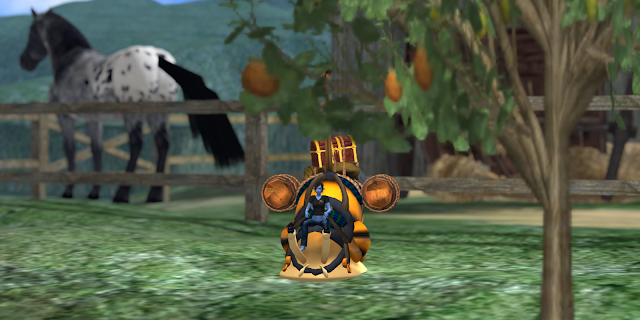
Zyx Flux, intrepid gardener and explorer, has filed another report from the field, a road trip along Route 14 on the Mainland. It is a relatively short trip, but it has some interesting elements. Here are her pictures and her commentary.
Shelly (my pack snail) and I were dropped off at one end of Route 14 in Mirandirge (
SLurl) by a friend's cargo dragon and we immediately acquainted ourselves with a handy map and read the informational sign. Not many roads in Second Life have such a spot and we were so so excited that Shelly and I had to take a quick nap to calm down before proceeding.
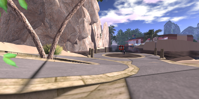
The beach right across the way from the information spot. Meh. I wasn't impressed and Shelly can't do salt water anyway, but I suppose it was a little pretty. The airplane was the first indication of an airport that a friend told us was in the area.
Right away Shelly and I climbed the stairs of an elegant ladies handbags shop so we could get some elevation for this view of the area around our start point. Mainland is such a diverse place with sections that mimic real life and others that defy all sense.
Tsurinton Airport in Slapdoogie (
SLurl) is Rez-enabled so anyone can use the facilities. I was told that the airport was not on the ground, but here it is ... on the ground. My sources are sometimes questionable, but at least there was an airport. And the view from the control tower is spectacular! Looking back toward the northwest you'll see an enormous cube with some sort of small in-land sea inside it and what looks like a very low-altitude space station above it. Shelly and I wanted to get on with the road trip but we made note of the location for later exploration.
Just over the Borgbeef line, one can see some wonderful architecture on the rolling landscape contrasted with half- and fully-finished skyboxes and the enormous cube again. Mainland is so incredibly diverse, but skyboxes sometimes bother me. At least one or two of these make some attempt (though likely not intentionally) to make the exteriors of the boxes attractive to those with very high draw distances (512m in this instance).
I left Shelly on the berm in a Rez zone (
SLurl) to snack and nap so I could fly over the complex with the nice greenhouse-like building we saw. It is an area called Lost Angels Office (
SLurl) and appears to be mostly empty buildings and a very hi-tech disco with lasers and other gadgetry. Some of it has ban lines and some doesn't, but if you like modern architecture, this is a nice place to visit.
It wasn't long before we slid up to the Seven Chickens Bridge in Gormthoog (
SLurl). There is a tragic and touching story of some apparently very depressed poultry behind the bridge's name and the info sign tells it in grisley detail (really, I think the author enjoyed the bloodshed). Just as I finished reading the sign, though, one of those autonomous and laggy AnnMarie Otoole vehicles that roam the highways unfettered attacked Shelly and drove us off the platform and back down the road whence we came. It took all my strength to fly the both of us out of harm's way and onto a grassy hill where we collapsed and fell asleep.
About an hour later, Shelly slimed my face to wake me and slid into her pack, waiting for me to secure it. She smelled a near by orchard and I smelled it, too, so we hurried down the road to load up on natural sugars and some fresh nature surroundings. Next door is a very vintage clothing store (
SLurl) in a very Victorian building.
Dead Mole Curve. It a sharp 90-degree curve on a steep hill. It would be hard to negotiate in a high speed vehicle, especially with those Anne Otoole vehicles aiming straight at the route map and info sign in an attempt to kill anyone who has stopped to use the adjacent rez zone or to read the signs. After taking this picture I hid behind the sign and magicked up a view so I could read it safely. Prim slides, speeding motorists, and other mishaps led to the death of 118 moles, according to the sign, in the construction of this portion of Route 14 in Gonkbrunk (
SLurl).
Hunkering down in an effort to handle the steep grades from the Curve onward, Shelly and I did little sightseeing. Don't get me wrong, though. The next stretch had some pleasant views but it wasn't very remarkable other than being fairly well-developed for Mainland. Actually, along the whole route we saw almost no abandoned or underdeveloped land. There were many empty buildings for rent either singly or in small shopping centers, but all-in-all, the regions are well populated (even if we didn't see very many people. What surpised us, though, was the lack of of large, purple crystals on the roadside. These are common on other roads across the mainland, sometimes even spotting two or more per region.
Eventually, though, we reached the official end of Route 14 in Wunb (
SLurl) and another map/info sign structure at the End of Line Inn. Past this, the road continues but on private land. Perhaps Shelly and I can travel that stretch for another blog post. For now, we are going to hop one of the frequent Yavapod tour cars and let it guide us around tourist-style.
My appreciation to Zyx for another fine post about Mainland sights. Several people have indicated that they'd like to see more of Zyx's writings here and so I've given her a company credit card so she can expense her trips for future reports. Search this blog for Road Trip or use the tag link below to find her earlier work. She has a list of places to visit and should be filing another report soon. -- Uccello


